Bosque, NM Hail Storm – June 2025
June 25, 2025 hail storm near Bosque, NM. Radar-confirmed hail track and contractor lead lists available.
Max Hail
0.75"1.25" est.
confirmed
Zones
1
NWS alerts
Radar
2
dual-pol hits
Spotter
–
field reports
NWS WARNING AREA · Bosque Metro · Jun 25, 2025
Intelligence Platform
StormSnipe Pro
$49/ mo
Cancel anytime · No contracts
›All 50 states
›No zone limits
›No per-event fees
Subscribe to Pro
Pro renews monthly until canceled · Cancel anytime in the billing portal
What's included
Instant delivery
Every storm published within hours of NOAA confirmation.
Interactive Strike Map
Full radar-confirmed hail track on an interactive map.
Address CSV export
Every affected residential address, export-ready.
Smart alerts
Notified when a storm hits your area. Set zones once.
Nationwide coverage
All 50 states. No zone restrictions. No geographic caps.
Live pipeline
NOAA NEXRAD processed and delivered 24/7.
Address data notice
Pro coverage in California, Vermont, and Oregon includes the confirmed hail track and Strike Map only — no address lists. State data-privacy law treats compiled address lists differently in those three states, so we exclude their addresses from extraction and delivery.
NWS WARNING AREA
NWS ABQ
Bosque, NM
Dual-Pol Radar
29 addresses in warning area
Alert issued Wed, Jun 25 · 9:27 PM UTC
0.75"
confirmed
1.25"
est. (NWS)
Bosque, NM was hit by a concluded severe hail storm on June 25, 2025. The peak confirmed hail size reached 1.25 inches.
What Happened
The storm affected Bosque in the late afternoon, with the main severe alert posted at 3:27 PM MDT. That alert carried a 1.25-inch hail estimate based on dual-polarization radar with NEXRAD hail detection confidence.
This was a single-zone storm report. One severe alert covered the event. The hail signal was tied to the Bosque area, and the event has since concluded.
The timing places the storm in the warm-season afternoon window when hail cores can strengthen quickly. The radar-derived hail estimate matched the reported peak size at 1.25 inches.
Damage Assessment
Hail at 1.25 inches is large enough to produce visible impact on roofs, gutters, siding, windows, and soft metals. Asphalt shingles can show granule loss, bruising, and localized cracking. Metal surfaces can show dents. Skylights and exposed glass can also take damage, depending on roof slope and storm path.
Vehicles parked in the warning area may show shallow to moderate denting, especially on horizontal panels. Roof-mounted HVAC equipment, vents, and exterior trim are common inspection points after hail at this size.
For field crews, the main issue is not uniform damage. Hail often falls in a narrow corridor. One property can show clear impact while a nearby one shows little or none. Roofing and exterior inspections should focus on the section of the warning area that saw the strongest hail core, not the full alert footprint.
What Contractors Should Know
Start with roof slopes, ridges, valleys, and north-facing exposures where impact is easier to spot. Check soft metals, flashing, vent caps, downspouts, and window screens before moving to cosmetic claims. On steep roofs, watch for impact marks that are harder to see from the ground. Use close inspection and photo documentation.
Siding and trim checks should include windward elevations, but hail can strike any side if the storm core passed overhead. Look for fractured vinyl, chipped paint, and punctures around corners and edges. On multi-structure properties, inspect detached garages, sheds, patio covers, and AC condensers. Smaller outbuildings are often hit in the same storm path and can help confirm the local hail footprint.
Contractors working Bosque should also compare roof slope, material age, and exposure between properties inside the warning area. The same storm can leave one roof needing repair and another with only minor cosmetic marks. Prioritize a consistent inspection routine so the findings line up across the hail corridor.
For precise hail track data, see the Strike Map.
Storm Details
- Start Date
- Wednesday, June 25, 2025
- Last Activity
- Wednesday, June 25, 2025
- Location
- Bosque, NM
- Warning Areas
- 1
- Dual-Pol Radar
- 2
- Spotter Reports
- --
Preview Strike Map
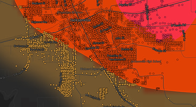
See exactly what you get.
Explore the full Springdale, AR Strike Map free – hail track, address overlay, and CSV download. No account required.
Try the Free Demo →