Marana, AZ Hail Storm – November 2025
November 19, 2025 hail storm near Marana, AZ. Radar-confirmed hail track and contractor lead lists available.
Max Hail
1.75"1" est.
confirmed
Zones
2
NWS alerts
Radar
3
dual-pol hits
Spotter
13
field reports
NWS WARNING AREA · Marana Metro · Nov 19, 2025
Intelligence Platform
StormSnipe Pro
$49/ mo
Cancel anytime · No contracts
›All 50 states
›No zone limits
›No per-event fees
Subscribe to Pro
Pro renews monthly until canceled · Cancel anytime in the billing portal
What's included
Instant delivery
Every storm published within hours of NOAA confirmation.
Interactive Strike Map
Full radar-confirmed hail track on an interactive map.
Address CSV export
Every affected residential address, export-ready.
Smart alerts
Notified when a storm hits your area. Set zones once.
Nationwide coverage
All 50 states. No zone restrictions. No geographic caps.
Live pipeline
NOAA NEXRAD processed and delivered 24/7.
Address data notice
Pro coverage in California, Vermont, and Oregon includes the confirmed hail track and Strike Map only — no address lists. State data-privacy law treats compiled address lists differently in those three states, so we exclude their addresses from extraction and delivery.
NWS WARNING AREAS · 2
This storm generated 2 NWS alert zones. Pro access covers the complete storm track and all addresses across every zone.
ZONE 1NWS TWC
Marana, AZ
Dual-Pol Radar
7,854 addresses in warning area
Alert issued Wed, Nov 19 · 7:54 PM UTC
1.5"
confirmed
1"
est. (NWS)
ZONE 2NWS PSR
Phoenix, AZ
Dual-Pol Radar
51,085 addresses in warning area
Alert issued Wed, Nov 19 · 11:54 PM UTC
1.75"
confirmed
1"
est. (NWS)
What Happened
A severe hail storm moved through Marana, AZ, on November 19, 2025, with peak hail measured at 1 inch and a spotter-verified report of nickel-size hail at 1:13 PM MST. The event was concluded by the end of the day.
The first NWS alert came at 12:54 PM MST with radar and spotter confidence for 1-inch hail in the warning area. A local storm report followed 19 minutes later from Marana, where a spotter said nickel-size hail fell for about 5 minutes and left the ground covered in stones. That report measured 0.88 inch.
Radar support and field reports lined up through the midday period. The storm stayed organized enough to keep hail production going as it crossed the Marana metro, with the verified report confirming a compact but active hail core at the surface.
Damage Assessment
The surface impact was consistent with a brief but concentrated hail burst. The spotter report from Marana described hail covering the ground after several minutes of sustained fall, which points to a clear accumulation event rather than scattered pellets.
In neighborhoods inside the warning area, the main concern was exposed property. Vehicles parked outdoors, rooflines, gutters, and light fixtures would have taken the first hit during the strongest part of the storm. The 1:13 PM MST report places the heaviest ground-level effects in the middle of the day, when many vehicles and work sites are exposed.
The report of nickel-size hail also suggests the storm held enough intensity to produce repeat strikes over a short window. That kind of hail field can leave visible pitting on softer materials, chipped edges on minor outdoor surfaces, and debris coverage in driveways and open lots. No large hail damage was reported in the data set, and the available field report points to a localized event rather than a long-duration swath of severe impact.
For Marana properties, the most likely checks after this storm would have been vehicle glass, roof accessories, skylights, and east- or south-facing exposures that were outside during the 12:54 PM to 1:13 PM MST window. The hail size stayed near the one-inch threshold, but the ground coverage described by the spotter shows the storm had enough volume to leave a measurable surface trace.
What Contractors Should Know
This Marana storm was brief, midday, and centered on a narrow hail core. That makes it a field check event, not a broad-area recovery event. Crews should focus on homes and businesses inside the warning area that had vehicles, roof components, or soft exterior finishes exposed during the early afternoon window.
The most practical inspection targets are the first things hail reaches at street level. Look at windshield chips, cracked trim, dented gutters, and bruised AC fins before moving to full roof assessments. In a storm like this, light surface impact can still coexist with scattered property claims, especially where cars were parked outdoors and where patios or covered entries had open edges.
Storm Details
- Start Date
- Wednesday, November 19, 2025
- Last Activity
- Wednesday, November 19, 2025
- Location
- Marana, AZ
- Warning Areas
- 2
- Dual-Pol Radar
- 3
- Spotter Reports
- 13
Preview Strike Map
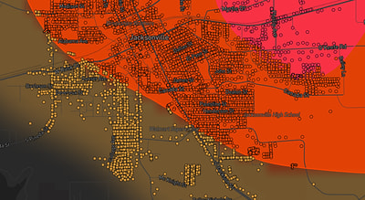
See exactly what you get.
Explore the full Springdale, AR Strike Map free – hail track, address overlay, and CSV download. No account required.
Try the Free Demo →