San Antonio, NM Hail Storm – June 2026
June 5, 2026 hail storm near San Antonio, NM. Radar-confirmed hail track and contractor lead lists available.
Max Hail
2"1" est.
confirmed
Zones
2
NWS alerts
Radar
523
dual-pol hits
Spotter
–
field reports
NWS WARNING AREA · San Antonio Metro · Jun 5, 2026
Intelligence Platform
StormSnipe Pro
$49/ mo
Cancel anytime · No contracts
›All 50 states
›No zone limits
›No per-event fees
Subscribe to Pro
Pro renews monthly until canceled · Cancel anytime in the billing portal
What's included
Instant delivery
Every storm published within hours of NOAA confirmation.
Interactive Strike Map
Full radar-confirmed hail track on an interactive map.
Address CSV export
Every affected residential address, export-ready.
Smart alerts
Notified when a storm hits your area. Set zones once.
Nationwide coverage
All 50 states. No zone restrictions. No geographic caps.
Live pipeline
NOAA NEXRAD processed and delivered 24/7.
Address data notice
Pro coverage in California, Vermont, and Oregon includes the confirmed hail track and Strike Map only — no address lists. State data-privacy law treats compiled address lists differently in those three states, so we exclude their addresses from extraction and delivery.
NWS WARNING AREAS · 2
This storm generated 2 NWS alert zones. Pro access covers the complete storm track and all addresses across every zone.
ZONE 1NWS NMC053
San Antonio, NM
Dual-Pol Radar
1,775 addresses in warning area
Alert issued Fri, Jun 5 · 10:22 PM UTC
2"
confirmed
1"
est. (NWS)
ZONE 2NWS NMC053
San Antonio, NM
Dual-Pol Radar
Alert issued Fri, Jun 5 · 11:34 PM UTC
1.5"
confirmed
1"
est. (NWS)
San Antonio, NM recorded a multi-zone hail event on June 5, 2026, producing up to 1.59 inches of hail. The storm passed through the metro in the late afternoon and concluded in the early evening.
What Happened
The event unfolded in the late afternoon into early evening. The National Weather Service issued two warning-area alerts for 1-inch hail at 4:22 PM MDT (22:22 UTC) and 5:34 PM MDT (23:34 UTC). Both alerts were based on dual-polarization radar detections that showed hail signatures moving across multiple warning areas in the San Antonio, NM metro. Radar-derived hail detections persisted between the two alerts as cells tracked generally northeast across the metro. Field activity for the event is concluded.
Damage Assessment
Both NWS alerts were radar-detected; no spotter-verified damage reports were appended to those warnings. Hail reached the recorded peak noted above. Hail of that magnitude commonly causes dents to unprotected vehicles, cracks or breakage of single-pane glass, and bruising to asphalt shingles, particularly on older or compromised roofs. Landscaping and outdoor equipment such as HVAC units and exposed solar modules are also vulnerable to this size of hail.
For properties within the NWS warning areas, prioritize photographic documentation of any roof granule loss, dented metal, cracked skylights, and vehicle body damage. Record exact locations, timestamps, and a brief description of observed material failures. Early documentation preserves claims evidence and supports efficient contractor triage.
What Contractors Should Know
Start with a safety-first assessment. Confirm that electrical systems are de-energized where water intrusion or shattered glass is present. Conduct a walkaround to map likely impact points, then perform a close-up inspection from a ladder or lift for shingle bruising, hail pitting on metal panels, and compromised flashings. Use scale references in photographs and capture GPS coordinates for each inspection point.
Estimate repair needs by distinguishing cosmetic versus functional damage. Prioritize temporary weatherproofing for active leaks and secure displaced elements that could cause secondary damage. For roofing, note areas with granule loss, split tabs, and exposed underlayment. For vehicles and equipment, document panel dents, broken glass, and dented housings. Provide customers with a concise written scope of recommended immediate actions and a separate schedule for full replacement if warranted.
Precise hail-track and damage-zone mapping are available in the paid Strike Map for this event.
Storm Details
- Start Date
- Friday, June 5, 2026
- Last Activity
- Friday, June 5, 2026
- Location
- San Antonio, NM
- Warning Areas
- 2
- Dual-Pol Radar
- 523
- Spotter Reports
- --
Preview Strike Map
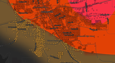
See exactly what you get.
Explore the full Springdale, AR Strike Map free – hail track, address overlay, and CSV download. No account required.
Try the Free Demo →