Mesa, AZ Hail Storm – September 2026
September 16, 2026 hail storm near Mesa, AZ. Radar-confirmed hail track and contractor lead lists available.
Max Hail
1.01"0.75" est.
confirmed
Zones
3
NWS alerts
Radar
12
dual-pol hits
Spotter
–
field reports
NWS WARNING AREA · Mesa Metro · Sep 16, 2026
Intelligence Platform
StormSnipe Pro
$49/ mo
Cancel anytime · No contracts
›All 50 states
›No zone limits
›No per-event fees
Subscribe to Pro
Pro renews monthly until canceled · Cancel anytime in the billing portal
What's included
Instant delivery
Every storm published within hours of NOAA confirmation.
Interactive Strike Map
Full radar-confirmed hail track on an interactive map.
Address CSV export
Every affected residential address, export-ready.
Smart alerts
Notified when a storm hits your area. Set zones once.
Nationwide coverage
All 50 states. No zone restrictions. No geographic caps.
Live pipeline
NOAA NEXRAD processed and delivered 24/7.
Address data notice
Pro coverage in California, Vermont, and Oregon includes the confirmed hail track and Strike Map only — no address lists. State data-privacy law treats compiled address lists differently in those three states, so we exclude their addresses from extraction and delivery.
NWS WARNING AREAS · 3
This storm generated 3 NWS alert zones. Pro access covers the complete storm track and all addresses across every zone.
ZONE 1NWS AZC013
Gila Bend, AZ
Dual-Pol Radar
Alert issued Wed, Sep 16 · 12:54 AM UTC
0.5"
confirmed
0.75"
est. (NWS)
ZONE 2NWS AZC013
Mesa, AZ
Dual-Pol Radar
1,671 addresses in warning area
Alert issued Wed, Sep 16 · 6:02 PM UTC
0.75"
confirmed
0.75"
est. (NWS)
ZONE 3NWS AZC027
Dateland, AZ
Dual-Pol Radar
Alert issued Wed, Sep 16 · 11:40 PM UTC
0.75"
confirmed
0.75"
est. (NWS)
Mesa, AZ — Mid-morning on September 16, 2026, a brief thunderstorm produced a peak hail diameter of 0.69 inch as it moved across the Mesa metro. The cell prompted a single midday hail warning and concluded without extended follow-on activity.
What Happened
The storm developed over the Mesa metro during mid-morning and moved east-northeast through the city. The National Weather Service issued one hail warning at 11:02 AM MST for potential 0.75-inch hail; the warning carried a NWS warning only status. The warning polygon covered a single corridor through the central metro and was not followed by additional NWS alerts.
Radar returns showed a compact reflectivity core as the cell passed over urban Mesa. Storm duration over any individual neighborhood was brief, on the order of minutes rather than tens of minutes. No spotter-reported large stones were attached to the NWS warning for this event.
The event is concluded. Local conditions returned to typical afternoon stability after the cell passed.
Damage Assessment
Peak stones measured below the size of a US penny (0.75 inch). Hail of this scale across an urban metro generally produces limited impact on durable building materials. Expect superficial paint scuffs and small dents to exposed vehicle panels where exposure was direct and unshielded. Plant foliage and shallow-rooted landscape can sustain leaf shredding and bruising when exposure is concentrated.
Roofing shingles, siding, and windows typically do not suffer structural failure from impacts under penny size unless existing deterioration or prolonged, repeated exposure occurred. Homeowners reporting leaks or punctures should document locations with date-stamped photos and note the street address and time of observation for any insurance or repair conversations.
What Contractors Should Know
For auto repair shops and mobile dent technicians: prioritize visual surveys for hail cosmetics on client vehicles within the storm corridor. Photograph vehicle panels, record the vehicle location and the local time of inspection, and log whether vehicles were parked outdoors or in covered structures. Small dents and paint imperfections are the most likely calls; provide clear before-and-after imagery to support estimates.
For roofing and exterior contractors: schedule quick visual roof walks focused on high-stress components such as flashings, hips, and ridge caps. Unless clients report active leaks, recommend a documented inspection first rather than immediate replacement. Where water intrusion is present, take photos of internal staining and the affected roof areas. Provide time-stamped estimates that note the observed hail size and the NWS warning time.
Paid users can view the Strike Map for the radar-confirmed hail swath.
Storm Details
- Start Date
- Tuesday, September 15, 2026
- Last Activity
- Wednesday, September 16, 2026
- Location
- Mesa, AZ
- Warning Areas
- 3
- Dual-Pol Radar
- 12
- Spotter Reports
- --
Preview Strike Map
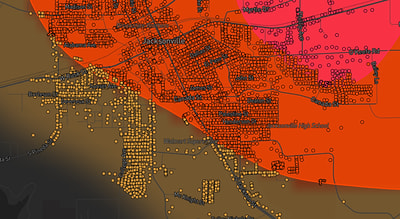
See exactly what you get.
Explore the full Springdale, AR Strike Map free – hail track, address overlay, and CSV download. No account required.
Try the Free Demo →